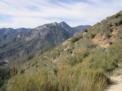
The Upper Bear Creek-to-Smith Mountain portion of the trail is moderate, with an elevation gain of 1900 feet. Already the mountains are turning green and the first wildflowers are blooming. At the saddle, you can choose to continue down into Bear Creek, or go off trail and climb the last 800 or so feet to the peak. We chose the peak. The path is quite steep and required us to do some rock climbing. The view at the top, as can be expected, is spectacular.
Speaking of Highway 39, on the day of our hike the Los Angeles Times ran a story that Caltrans is seeking to abandon the portion of the highway that crosses the San Gabriel Mountains because of the $1.5 million annual cost to maintain it amid frequent landslides, earthquakes and fires. It wants to transfer the responsibility to either the U.S. Forest Service or to Los Angeles County, both of which have declined.
Caltrans spends nearly $13 billion--billion, with a b--to maintain California roads, and it considers abandoning Highway 39 a way to save money (under 2 million--million, with an m).
Caltrans has maintained the road under a special permit since the 1920s. For its part, the Forest Service maintains that if Caltrans abandons the highway, it must, according to the permit, return the road to the natural landscape--meaning to remove it entirely.
Is Caltrans bluffing? Stay tuned.


No comments:
Post a Comment